

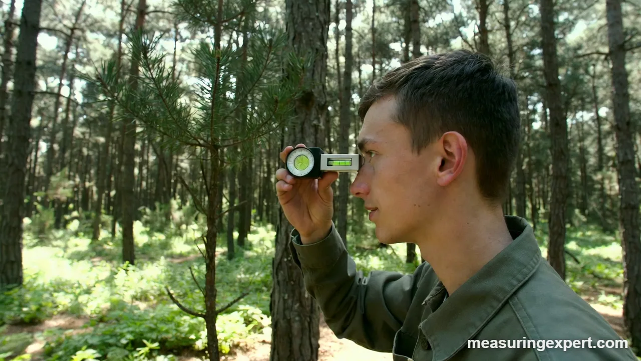
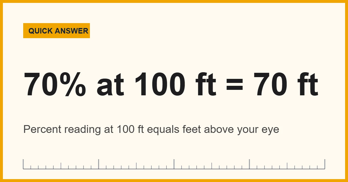
A clinometer is a handheld instrument that measures the angle of a slope, or the angle up or down to a target, relative to level ground. Foresters use one to find tree height: at 100 feet from the trunk, the percent-scale reading to the treetop equals the height in feet above your eye.
To begin with, the name comes from the Greek word for “slope” plus “meter”. In practice, a clinometer answers two everyday questions. First, how steep is this hill, roof or road? Second, how tall is that tree, pole or building when you cannot climb it or run a tape up the side?
To do that, the tool compares your line of sight with gravity. For instance, a weighted dial (or an electronic sensor) always hangs toward the center of the Earth, so the scale shows how far your sight line tilts above or below horizontal. Then simple trigonometry turns that angle and your distance from the object into a height.
In short: point it, read the angle, measure how far away you stand, and multiply. The calculator below does the multiplying for you.
Forestry extension services teach exactly this method to landowners. For example, the University of Maryland Extension fact sheet Woodland Management: Measuring Your Forests explains that a clinometer’s topographic and percent scales read height directly at 66 feet and 100 feet from the tree. In addition, Iowa State University’s guide to measuring tree height using a clinometer walks through the same two distances and shows how to handle sloped ground.
Find a Tree’s Height With a Clinometer
Enter your horizontal distance to the base, the angle to the top in degrees, and your eye height. The result assumes level ground; for slopes, use the two-reading method further down.
The formula is height = distance x tan(angle) + eye height. So with the default values, 20 m x tan(40 degrees) = 16.8 m, and adding 1.6 m of eye height gives about 18.4 m (60.3 ft).
Recommended Clinometers and Angle Tools
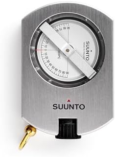
First, pick the tool by the job. Foresters and hikers usually carry an optical sighting model because it needs no batteries. Meanwhile, surveyors who also need distance often step up to a laser hypsometer, and geologists favor a pocket transit that combines a compass with a clinometer. For carpentry and machine setup, however, a digital angle gauge that sits on a surface is the better fit. The list below covers each of those needs, based on manufacturer specs and buyer reports.


As an Amazon Associate, Measuring Expert earns from qualifying purchases.
- It measures tilt from horizontal, in degrees, percent, or both.
- Percent = rise / run x 100, so 45 degrees equals 100 percent.
- At 100 ft from a tree, a percent reading equals feet above eye level.
- At 66 ft (one surveyor’s chain), the topographic scale reads feet directly.
- On a slope, take a reading to the top and one to the base, then combine them.
- Always use horizontal distance, not the distance along the ground.
- A 1-degree reading error at 20 m and 40 degrees shifts the height by about 0.6 m.
How a Clinometer Works
Every version relies on the same idea: gravity gives you a reliable “down”, and therefore a reliable horizontal. In an optical model, a weighted scale card floats inside a sealed housing filled with damping liquid. Because the weight always hangs straight down, the card stays level while the housing tilts with your hand. As a result, the number under the hairline is the angle between your sight line and horizontal.
Digital models replace the weighted card with an accelerometer chip. The chip also senses which way gravity pulls on each axis and converts that into an angle. Smartphone apps work the same way, since every modern phone already has an accelerometer inside.
Once you have the angle, the geometry is a right triangle. In this case, your horizontal distance to the object is the bottom side, and the height above your eye is the upright side. Then the tangent of the angle links the two: rise = distance x tan(angle). Finally, you add your eye height (or the base reading on a slope) to get the full height from the ground.
Clinometer Scales: Degrees, Percent and Topo
In fact, most forestry instruments show two scales side by side, and this is where beginners get confused. First, the degree scale gives the true angle from horizontal. The percent scale, by contrast, gives rise over run, multiplied by 100. So a 10 percent slope climbs 10 feet for every 100 feet of horizontal travel, which is only about 5.7 degrees.
Foresters prefer percent because it skips the trigonometry. At 100 feet from the tree, a reading of 62 percent to the top means the treetop is 62 feet above your eye. Similarly, the topographic (topo) scale is set up for 66 feet, the length of one surveyor’s chain, so at that distance the topo reading equals feet directly.
| Degrees | Percent grade | Roof pitch (rise in 12) | Feet above eye at 100 ft |
|---|---|---|---|
| 5.7° | 10% | 1.2 in 12 | 10 ft |
| 10° | 17.6% | 2.1 in 12 | 17.6 ft |
| 20° | 36.4% | 4.4 in 12 | 36.4 ft |
| 30° | 57.7% | 6.9 in 12 | 57.7 ft |
| 35° | 70.0% | 8.4 in 12 | 70.0 ft |
| 45° | 100% | 12 in 12 | 100 ft |
| 60° | 173.2% | 20.8 in 12 | 173.2 ft |
Notice that percent climbs much faster than degrees past 45. That is why steep readings are hard to take accurately on a percent scale, and also why foresters back up until the angle to the top is moderate. To switch between the three systems for your own numbers, use this converter:
For angle math beyond slopes, see our guide on converting angles from degrees to radians.
Types of Clinometer
All of them measure the same angle. Instead, what changes is how you aim, how you read the number, and how much the tool can do besides.
| Type | How you use it | Best for | Trade-offs |
|---|---|---|---|
| Optical sighting (Suunto-style) | Hold to one eye, sight the target, read the floating scale | Tree height, forest slope, field work | No batteries; takes practice to read with both eyes open |
| Electronic sighting | Aim through a sight, press a button, read a display | Faster inventories, low light | Needs batteries; costs more |
| Laser hypsometer | Measures distance and angle, then calculates height | Pros who measure many trees | Highest price; needs a clear line to the target |
| Compass with clinometer (pocket transit) | Sight or lay it on a rock face | Geology, mapping strike and dip | Slower to read than a dedicated unit |
| Smartphone app | Sight along the phone edge or use the camera view | Quick estimates, students | Accuracy depends on calibration and the case |
| Simple protractor and plumb line | Sight along a straw; a weighted string marks the angle | Classroom projects | Rough; hard to hold steady |
Marine and off-road versions also exist. For example, these mount on a bulkhead or dashboard and show how far a boat heels or a vehicle tilts. They are useful for safety. However, they are not built for sighting a distant target.
Clinometer vs Inclinometer vs Angle Finder
In everyday speech, people use these names loosely, and many shops sell the same tool under all three. Still, there are useful differences in how professionals use the words.
| Term | Usually means | Measures against | Typical user |
|---|---|---|---|
| Clinometer | A handheld sighting tool for slope and height | Gravity (horizontal) | Foresters, hikers, geologists |
| Inclinometer | A tilt sensor or gauge; in geotechnical work, a probe that tracks ground movement in a borehole | Gravity | Engineers, vehicle and machine builders |
| Digital angle finder | A gauge that sits on a surface or measures between two arms | Gravity or the other arm | Carpenters, machinists |
The core idea of measuring tilt is explained in more depth in our article on what the angle of inclination is and how it is measured.
How to Measure Tree Height Step by Step
This is the classic forestry method on level ground with a percent-scale instrument. You need the clinometer, a tape measure, and a partner if possible.
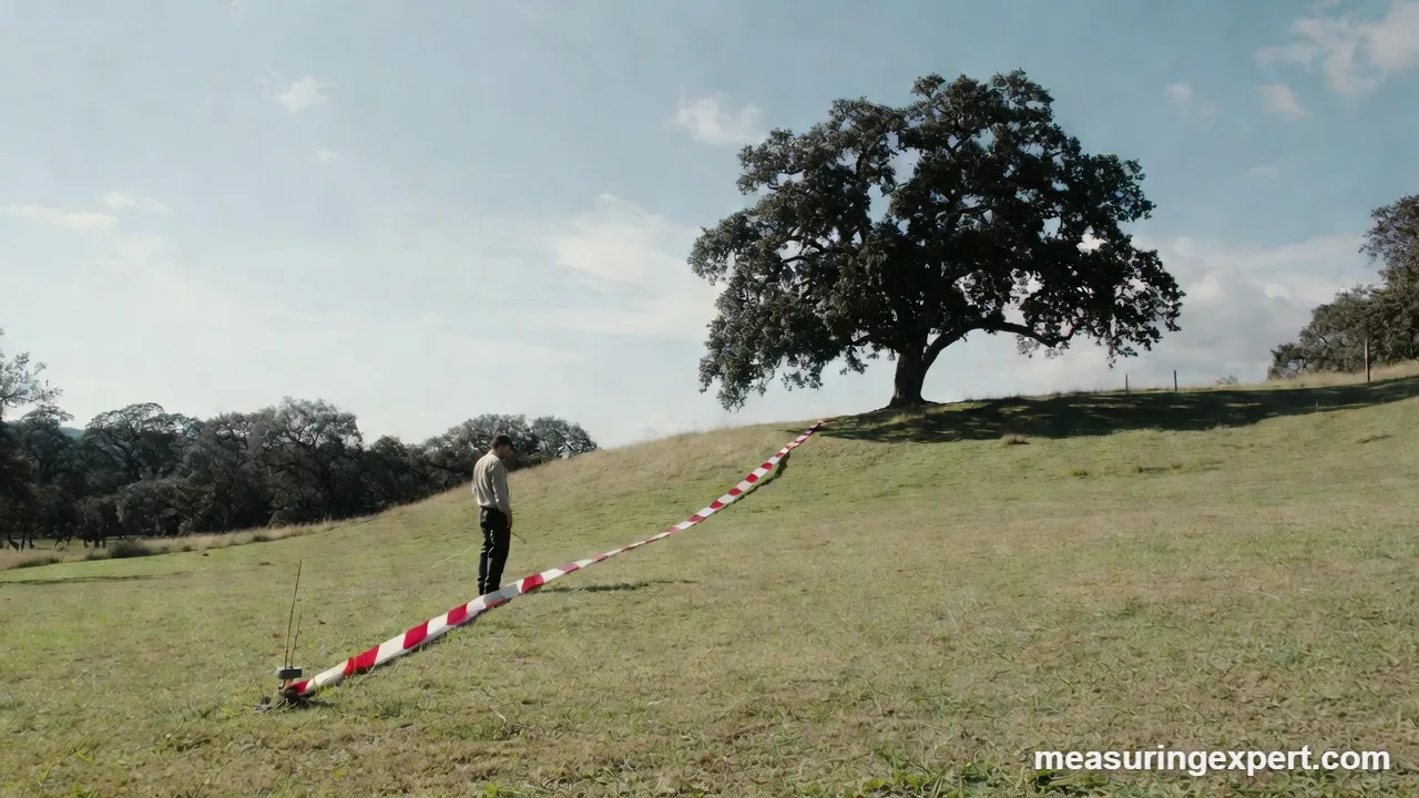
- Choose a clear view. Pick a spot where you can see both the base and the very top of the tree, ideally roughly as far away as the tree is tall.
- Measure the horizontal distance. Run a tape 100 ft (or 66 ft for the topo scale) from the center of the trunk. In metric, 20 or 30 m works well with the calculator.
- Sight the top. Keep both eyes open: one looks through the lens at the scale, the other at the treetop. Then line the hairline up with the highest leader.
- Read and write it down. Note the percent reading, for example 62.
- Sight the base. Next, aim at the point where the trunk meets the ground and record that reading, for example -8.
- Combine the two. If one reading is positive and one negative, add their sizes: 62 + 8 = 70 ft. If both are positive, subtract the base from the top instead.
- Check it. Finally, repeat from a second spot around the tree and average the two results.
In effect, the base reading replaces your eye height, so it also corrects for small dips and rises in the ground. Alternatively, on truly flat ground, you can skip it and add your measured eye height, as the calculator above does.
Measuring on a Slope
Hills are where most height errors come from. Fortunately, two rules keep you right. First, the rule of combining readings still works: add when your eye is between the base and the top, and subtract when both the base and the top are above you. Iowa State’s example is a base reading of 9 and a top reading of 42, which gives 42 – 9 = 33 ft.
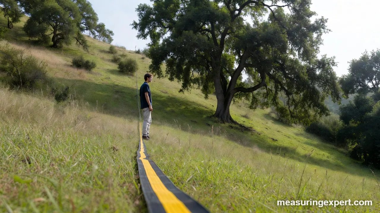
Second, the distance must be horizontal. If you measure 100 ft along the ground on a 20 percent slope, the true horizontal distance is only about 98.1 ft, because 100 x cos(11.3 degrees) = 98.1. For gentle slopes the difference is small. On steep ground, though, it grows quickly, so either correct the distance or move to a flatter spot.
Other Uses: Slopes, Roofs, Rock and Boats
Tree height is the famous job, but it is far from the only one:
- Trail and road grades. Sight a partner’s eye level up the slope to read percent grade, which is how many trail plans and logging roads are laid out.
- Building and pole height. Similarly, the same triangle works for a flagpole, a cell tower or the eave of a house.
- Geology. Likewise, a compass with a built-in clinometer reads the dip of rock layers.
- Avalanche terrain. Backcountry skiers check slope angle, because most slab avalanches start on slopes of roughly 30 to 45 degrees.
- Loose materials. Laying the tool on a pile of sand or gravel gives its angle of repose.
- Boats and vehicles. Mounted versions show heel or side tilt so the driver or skipper can stay within safe limits.
Do and Don’t
Do
- Measure horizontal distance with a tape or rangefinder.
- Also take both a top and a base reading.
- Stand back until the angle to the top is moderate.
- Sight the true top, not a branch tip nearer to you.
- Repeat from a second position and average.
Don’t
- Pace distances on steep ground and trust the result.
- Mix up the percent and degree scales, because they differ.
- Measure a leaning tree from the side it leans toward.
- Rely on a phone in a thick or uneven case.
- Stand where a falling limb could reach you.
Honest Limits: How Accurate Is a Clinometer?
The instrument itself is rarely the weak link. Instead, most errors come from how it is used. For example, at 20 m away with a 40-degree reading, a 1-degree mistake in the angle changes the answer by about 0.6 m. Likewise, a 1 m error in distance at that same angle moves the result by about 0.84 m, because tan(40 degrees) is 0.84.
Tree shape matters as well. On a broad, rounded hardwood crown, the highest point is hard to see from below, so people often sight a near branch and overestimate the height. Leaning trees cause similar trouble: if the top leans toward you, the triangle no longer matches reality. In addition, wind, low light and a shaky hand add more spread. Therefore, treat a single reading as an estimate to within a few percent, and average several readings when the number matters.
Phone apps deserve one more caveat. Of course, their sensors are good, but a bent case, a camera bump or skipped calibration can add a degree or more. So they are fine for a rough slope check, while a dedicated instrument is the safer choice for timber or engineering work.
When to Call a Professional
In general, a handheld tool is ideal for estimates, school projects and woodland planning. However, some decisions need certified work. Hire a consulting forester for timber sales or valuations, a licensed land surveyor for property lines, grading plans or building heights tied to permits, and a certified arborist when a tall tree near a house looks unsafe. Likewise, slope stability near structures is a job for a geotechnical engineer.
Frequently Asked Questions
What is a clinometer used for?
It measures slope angles and the angle up or down to a target. Foresters use it for tree height, while hikers, geologists and builders use it to check slopes and rock layers.
How do you use a clinometer to measure tree height?
Stand a measured horizontal distance from the trunk, sight the top and the base, then combine the readings. At 100 ft on the percent scale, the readings equal feet directly.
Is a clinometer the same as an inclinometer?
The words are often used for the same tool. Even so, clinometer usually means a handheld sighting instrument, while inclinometer often means a tilt sensor or a borehole instrument.
What does the percent scale on a clinometer mean?
It shows rise over run times 100. A reading of 50 percent means 50 ft of rise per 100 ft of horizontal distance, which is about 26.6 degrees.
Why do foresters stand 66 feet from a tree?
66 ft is one surveyor’s chain. The topographic scale is set up so that, at that distance, the reading equals the height in feet above or below your eye.
How accurate is a clinometer?
Careful users get within a few percent of the true height. Most error comes from distance, finding the true top and leaning trees rather than from the tool itself.
Can I use my phone as a clinometer?
Yes, for estimates. Calibrate the app on a level surface, remove a bulky case, and expect less consistency than a dedicated instrument.
What is 45 degrees in percent?
45 degrees is 100 percent, because the rise equals the run. Past 45 degrees, percent values climb very quickly.
How do I measure height on a slope?
Take a reading to the top and one to the base. Add them if one is positive and one is negative, subtract the base if both are positive, and use horizontal distance.
Can I make a simple clinometer at home?
Yes. Tape a straw along a protractor and hang a weighted string from its center. The string shows the angle, though results are rougher than with a real instrument.
Bottom Line
A clinometer turns an angle and a distance into a height or a slope. In other words, stand at a known horizontal distance, sight the top and the base, and either read feet straight off the percent scale at 100 ft or let the calculator above do the trigonometry.
For woodland planning, trail work and curiosity, a simple optical model is plenty. If you measure many trees, a laser hypsometer saves time, and for legal or safety decisions, a licensed professional should take the final measurement.
4 thoughts on “What Is a Clinometer and How Is It Used to Measure Angles and Height?”