
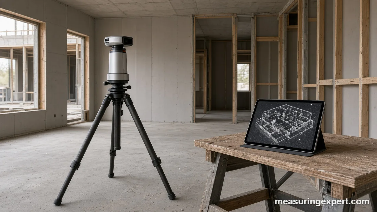
AI construction measurement means software that turns photos, laser scans, or drawings into quantities such as lengths, areas, and volumes. Instead of tracing every wall by hand, a model finds walls, slabs, and materials on its own. However, accuracy depends on the input data, so crews still spot-check key dimensions.
Convert Site Areas After AI Construction Measurement
Most AI tools report areas in one unit only. As a result, you may need to switch between square feet and square meters before you order materials. Enter any area below, and the converter shows the other units using exact definitions.
Why AI Construction Measurement Matters
Construction teams have always measured first and built second. Today, a growing share of that measuring happens inside software. Cameras, drones, and laser scanners capture a site, and then algorithms pull out the numbers. In short, AI construction measurement speeds up the counting, tracing, and calculating that used to fill hours of office time.
That speed is useful, but it does not remove the need for judgment. For example, a model can trace a floor plan in seconds and still read a scale bar wrong. Therefore, this guide explains how the technology works, where it helps, and where you should still pick up a tape.
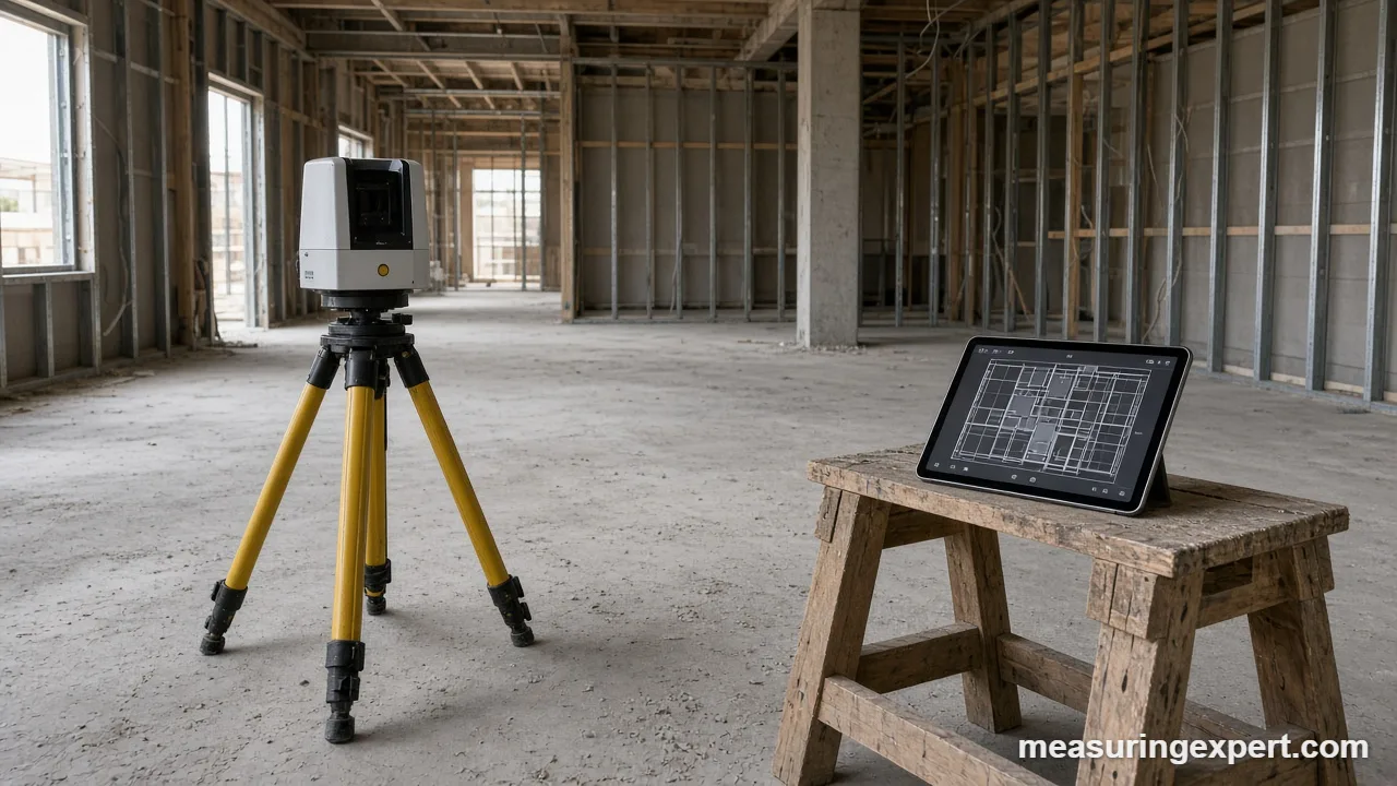
The research side backs up the basics. The National Institute of Standards and Technology (NIST) has used laser radar scanning to track construction sites and build as-built 3D models, according to a published research paper on construction scanning. Below, you will find the main methods, a worked example, and a checklist.
- How AI construction measurement works
- The main technologies
- Accuracy of AI construction measurement
- A worked example: slab takeoff
- Where AI beats manual measuring
- Honest limits
- Recommended tools for checking AI measurements
- How to verify AI construction measurement results
- Do and don’t
- When to call a professional
- FAQs
Key Takeaways
- AI turns images, scans, and plans into lengths, areas, and volumes.
- The input data sets the ceiling: blurry photos or a wrong scale give wrong numbers.
- Drone photo accuracy is tied to ground sampling distance (GSD), the ground size of one pixel.
- One NIST research scanner had a typical distance error of about 20 mm (0.79 in).
- Spot-check at least two or three dimensions with a tape or laser measure.
- Always add a waste allowance, because AI quantities are net, not ordered amounts.
- Large or safety-critical measurements still need a licensed surveyor.
How AI Construction Measurement Works
In general, every system follows the same three steps. First, it captures data. Next, a model finds the objects that matter. Finally, software converts those objects into quantities.
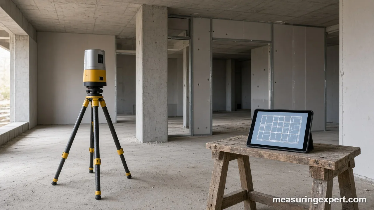
For example, capture comes from several sources. A phone or drone takes overlapping photos, while a laser scanner records millions of distance points. In addition, plan takeoff tools read PDF drawings. Because each source has its own error, the result is only as good as the capture.
Detection comes next. A computer vision model labels pixels or points as wall, floor, door, rebar, or pile of soil. Similarly, a drawing tool finds room outlines and reads the dimension text. Then the software measures those labeled shapes using a known scale.
Finally, the tool reports quantities. For example, it may list wall length in feet, floor area in square feet, and soil volume in cubic yards. If you need a refresher on area math, see our guide to the area of a shape.
The Main Technologies Behind AI Construction Measurement
| Technology | What it captures | Typical use |
|---|---|---|
| Photogrammetry | Overlapping photos turned into 3D models | Site surveys, stockpile volumes, progress maps |
| Laser scanning (LiDAR) | Millions of distance points from laser pulses | As-built models, clash checks, tight interiors |
| Computer vision | Labels for objects in photos or video | Counting items, tracking progress, safety checks |
| Plan takeoff AI | Shapes and text read from drawings | Floor areas, wall lengths, material lists |
| Machine learning estimates | Patterns from past projects | Waste factors, quantity forecasts |
Machine learning sits behind most of these tools. It learns patterns from labeled examples, so it improves when it sees clean data. However, it can also repeat old mistakes if the training data was sloppy.
Laser scanning deserves a closer look because it is the most direct method. A scanner sends out pulses and times how long they take to return. As a result, it records distances rather than guessing them from pixels. For a deeper comparison, read our post on laser scanning vs traditional methods.
Accuracy of AI Construction Measurement
Because accuracy matters, people often ask how accurate these tools are. The honest answer is that it depends on the capture method and the setup. Moreover, a single “survey-grade” label hides many factors.
Drone Photos and AI Construction Measurement
For drone photos, however, the key number is ground sampling distance. GSD is the ground size of one image pixel. You can estimate it as sensor width times flying height, divided by focal length times image width in pixels. For example, take a 13.2 mm wide sensor, an 8.8 mm lens, and 5,472 pixels across. At 100 m (328 ft), GSD is about 2.74 cm (1.08 in) per pixel.
| Flying height | GSD (same camera) | Rule-of-thumb horizontal accuracy |
|---|---|---|
| 50 m (164 ft) | 1.37 cm (0.54 in) | 1.4 to 2.1 cm (0.54 to 0.81 in) |
| 100 m (328 ft) | 2.74 cm (1.08 in) | 2.7 to 4.1 cm (1.08 to 1.62 in) |
| 120 m (394 ft) | 3.29 cm (1.30 in) | 3.3 to 4.9 cm (1.30 to 1.94 in) |
The accuracy column uses a rule of thumb from a photogrammetry journal column: horizontal accuracy should ideally be 1 to 1.5 times the GSD. That column, published by the American Society for Photogrammetry and Remote Sensing, also warns that this is not guaranteed. Georeferenced accuracy cannot beat the accuracy of your ground control points.
Laser Scanners and Accuracy
On the other hand, laser scanners work differently. In the NIST paper, a custom scanner had a typical distance accuracy of about 20 mm (0.79 in). In the worst case, dust and air effects pushed that to 50 mm (1.97 in). Also, its range was about 150 m (492 ft) on highly reflective surfaces and about 50 m (164 ft) on darker ones. Modern commercial scanners differ, so always read the manufacturer spec sheet.
A Worked Example: Slab Takeoff
For example, suppose an AI tool traces a rectangular slab at 40 ft by 30 ft. The area is 1,200 sq ft, or 111.48 sq m. With a 4 in (101.6 mm) thickness, the volume is 400 cu ft. That equals 14.81 cu yd, or 11.33 cu m.
Next, add a waste allowance. As an example, a 10% allowance gives 16.30 cu yd to order. However, your supplier or engineer may recommend a different figure, so ask them.
Next, think about error. If the tool overstates the area by 1%, it adds 12 sq ft. That sounds small, yet on a large pour it adds up fast. So a quick tape check of one side is cheap insurance.
Where AI Beats Manual Measuring
- Speed. A drawing takeoff that took hours by hand can take minutes.
- Coverage. For instance, a drone can map a whole site in one flight, including places that are hard to reach.
- Consistency. Software applies the same rules every time, so two estimators get the same trace.
- Records. Scans and photos create a dated record of the site. As a result, disputes are easier to settle.
- Safety. Remote capture keeps people away from edges, trenches, and traffic.
Because of these gains, many teams use AI for the first pass. Then they use people for the decisions.
Honest Limits of AI Construction Measurement
Even so, no tool is perfect. First, bad input gives bad output: motion blur, shadows, glare, and dust all hurt photos and scans. Second, scale errors are common. If a drawing is printed at the wrong size, the AI may report every length wrong by the same percentage.
Third, models misread things. For instance, a model might count a shadow as a wall edge or skip a thin pipe. In addition, a model trained on one building type may struggle with another. Finally, a tool measures what it can see. Hidden pipes, buried utilities, and concealed framing stay invisible to cameras.
Also remember that every output is a net quantity. It does not include waste, overlap, cuts, or spillage. Our list of common construction measurement mistakes covers many of the same traps.
Recommended Tools for Checking AI Measurements
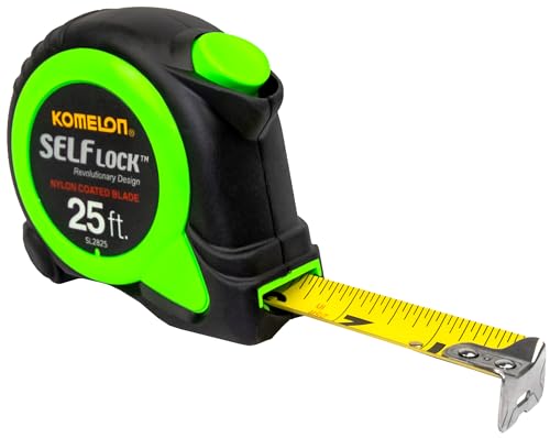
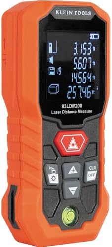
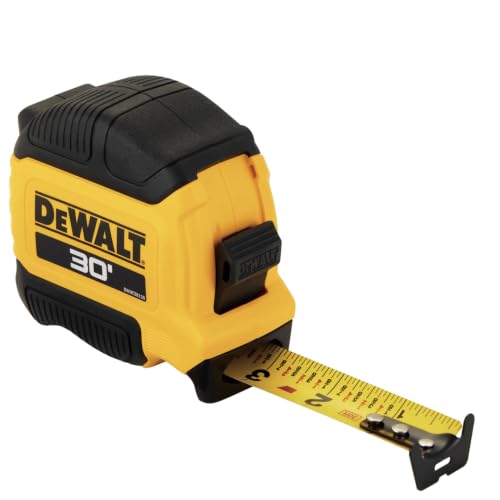
A simple physical check catches most AI errors. A laser distance measurer gives fast spot checks across a room. Meanwhile, a sturdy tape handles short runs and tight corners. First, look for a stated accuracy and a clear display. Next, check the range for your typical room or lot.



As an Amazon Associate, Measuring Expert earns from qualifying purchases.
How to Verify AI Construction Measurement Results
- Confirm the scale. Find a known dimension on the drawing or in the scan, such as a standard door width, and compare it with the tool’s reading.
- Pick check dimensions. Choose two or three long, easy-to-reach lengths in different directions.
- Measure them directly. Use a tape, a laser measure, or a total station. Our guide on how to use a total station helps with larger sites.
- Compare the results. Work out the percentage difference between the AI value and your reading.
- Decide on a tolerance. Agree on an acceptable error before the job starts, based on the material and the trade.
- Add waste and rounding. Convert units if needed with the calculator above, then add the allowance your supplier recommends.
- Record the check. Save the readings with the date, so you can trace any problem later.
Do and Don’t With AI Measurements
Do
- Check scale on every new drawing or scan.
- Capture in good light with plenty of overlap.
- Use ground control points for survey-style drone work.
- Keep units consistent from capture to order.
- Log every spot check you make.
Don’t
- Trust one number without a second source.
- Order material without a waste allowance.
- Assume hidden work appears in a scan.
- Mix feet and meters in one takeoff.
- Skip the professional for legal boundaries.
When to Call a Professional
First, hire a licensed land surveyor for boundaries, setbacks, and anything with legal weight. Similarly, ask a structural engineer when measurements feed into load or safety calculations. A calibration lab can certify your own instruments if a contract requires it.
Frequently Asked Questions
What is AI construction measurement?
It is the use of AI software to pull lengths, areas, and volumes from photos, scans, or drawings. People then review the results and use them for estimates and plans.
How accurate is AI construction measurement?
It depends on the input. Drone photo accuracy is often a small multiple of the GSD, such as 1 to 1.5 times. Laser scanners can be tighter, so check the spec sheet.
Can AI replace a tape measure on site?
No. Although AI handles large areas quickly, a tape or laser measure is still the best way to check key dimensions and fit small parts.
What does GSD mean in drone measuring?
GSD stands for ground sampling distance. It is the ground size of one image pixel, for example 2.74 cm (1.08 in) per pixel at 100 m (328 ft) with the camera in this guide.
Does AI construction measurement save money?
It can cut office time and reduce missed quantities. However, savings depend on clean data and on how well your team checks the results.
Which tools work best with AI takeoff results?
A laser distance measurer and a quality tape measure are the most useful for spot checks. A total station helps on larger sites.
Why are my AI measurements off by the same percentage?
Therefore, that pattern usually points to a scale error. Measure one known length on the plan or scan and correct the scale.
Is a scan better than photos for AI measurement?
A laser scan records distances directly, so it is often stronger indoors and in tight spaces. Photos cover large outdoor areas at lower cost.
How do I convert AI area results to square meters?
Multiply square feet by 0.09290304 to get square meters. For example, 1,200 sq ft equals 111.48 sq m. The converter above does this for you.
Should I add waste to AI quantities?
Yes, because AI quantities are net amounts. Add the waste allowance your supplier or engineer recommends before you order.
AI Construction Measurement: The Bottom Line
To sum up, AI construction measurement is a fast first pass that turns photos, scans, and plans into usable quantities. It works best with clean data, a verified scale, and a few direct checks.
So use the technology for speed, and use a tape or laser for proof. Finally, add waste, keep your units straight, and call a professional for anything legal or structural.